|
||||
|
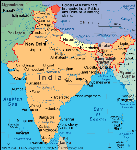
The Indian Subcontinent: A Geographical Sketch
The Indian subcontinent is a 2000-mile-long triangle that is suspended off the landmass of Central Asia. Bounded on the north by the Himalayas, the land is accessible from that direction only through a number of northwestfacing passes. The Arabian Sea forms the western boundary and the Bay of Bengal the eastern one. The subcontinent can be roughly divided into geographic units. The northern region extends from the northwest lands watered by the Indus River to the northeastern region watered by the Ganges River. Rajastan and the Punjab hills are in this region. The central area, south of the Vindhya mountain range, is called the Deccan and includes hill and forest zones as well as the high and arid Deccan plateau. The southern region is separated from the rest of the land by the Nilgiri Hills. The climate is largely tropical with rainfall for much of the subcontinent dependent on the monsoon winds that blow across the Indian Ocean from June to October. However the plains of the northern regions, where great rivers are fed by melting mountain snows, are less dependent upon the winds than is peninsular India in the south. Home
| Slideshow | Looking
at Art | Lesson Plans | |