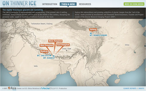
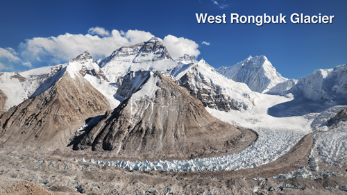
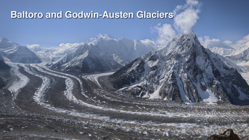
The photos below link to interactive panoramas of the West Rongbuk Glacier on the north face of Mount Everest and the Baltoro and Godwin-Austen Glaciers near K2.
For best viewing, activate the “Full Screen” option after clicking through to the panorama. Use the “Timetravel” button to see what the glaciers looked like when Major E.O. Wheeler and Vittorio Sella took the same panoramas in the early 1900s.

“Then and Now” photographs with interactive map.
Contemporary panoramas photographed by David Breashears. Interactive gigapan technology developed and hosted by Christian Bloch. On Thinner Ice developed for GRIP by MediaStorm.


[...] Glacial Time Machine [...]
Pingback by Photos Reveal Receding Himalaya Glaciers - Lens Blog - NYTimes.com — July 16, 2010 @ 2:06 pm
[...] This post was Twitted by oceankai [...]
Pingback by Twitted by oceankai — July 20, 2010 @ 8:21 am
[...] for even more, see the interactive, comparative photography, and video links [...]
Pingback by GetFastLoanOnline.com » Blog Archive » Receding Glaciers of the Greater Himalaya — July 23, 2010 @ 6:57 am
[...] comparison of a pair of panoramas photographed at the start of the 20th century to the same panorama photographed today. You can argue that it doesn’t “prove” Man Made Global Warming, but something [...]
Pingback by Bloodstar » So, What Happened to the Glaciers? — July 23, 2010 @ 5:43 pm
[...] 1903 expedition to Tibet. The Asia Society’s Rivers of Ice project offers a more sobering photographic record of the Himalaya today, chronicling, in mega-pixel detail, the effects of global warming on [...]
Pingback by Exploration Round-Up « Time to Eat the Dogs — October 25, 2010 @ 2:52 pm